@ndygol привет, передаю вам ответ Mapbox по ситуации с Блумбергом и Крымом
Our platform emphasizes customizability: users can filter our data or bring their own to create the mapping experience that is most appropriate for their audience. We try to ensure that our customers can make their own decisions about disputed borders. You may have read about our
Worldviews functionality, which currently supports boundaries that match the expectations of Chinese and Indian audiences.
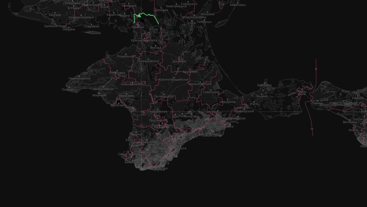
In the case of Crimea, our data includes geometry for both the pre-2014 border and the more recent border claimed by Russia. The latter is flagged as "disputed" in the dataset. The attached image shows our default data's current administrative borders. The border with the "disputed" tag is bright green. As you can see, even Either, both or neither can be displayed using our flexible cartographic tools. Our customers can also upload their own border data. You can see all of this for yourself if you register for a free account at
Mapbox.com and get acquainted with Mapbox Studio.
We believe that territorial disputes should be resolved by institutions more august than mapping companies. Our goal is to make it easy for our customers to produce the map they wan